 Image 1 of 1
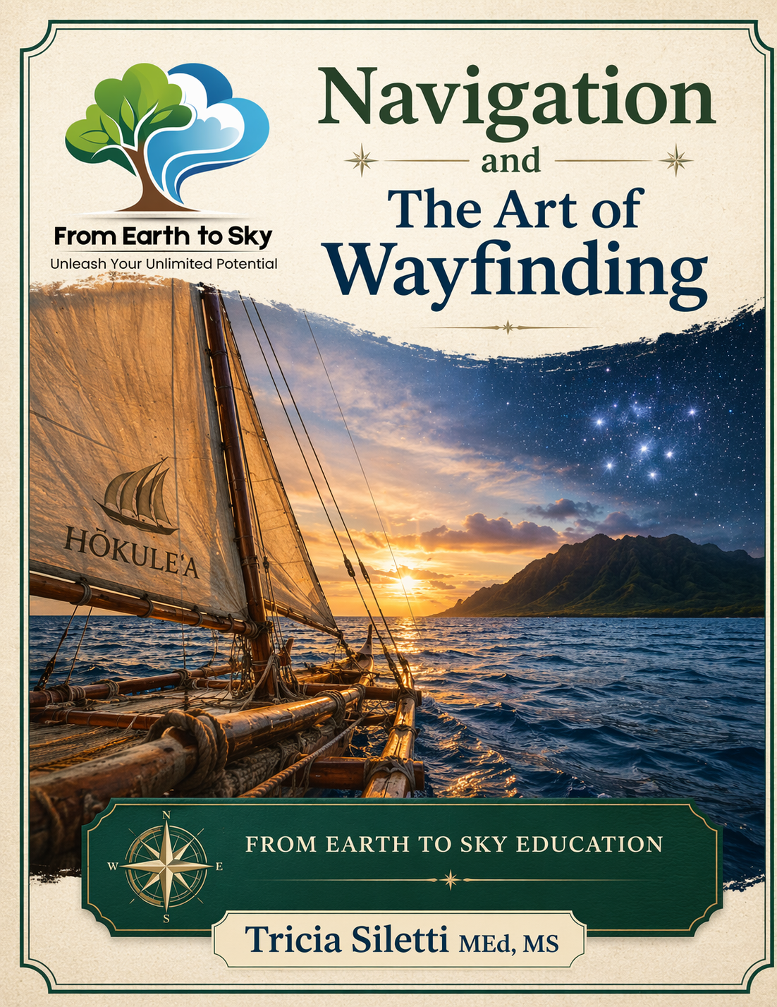
A Hands-On High School Course | From Earth to Sky Education
Chart your course. Trust yourself. Navigate the world with confidence.
Step beyond GPS and into the timeless science of navigation. Navigation and the Art of Wayfinding is a comprehensive, project-based high school course that teaches students how to read the land, the ocean, and the sky using both ancient wisdom and modern tools.
Designed for homeschool families, educators, and independent learners, this course transforms navigation from a technical skill into a powerful life practice rooted in awareness, observation, and confidence.
This is not a textbook course. It is an immersive learning experience where students actively practice real-world navigation skills through:
Star navigation and celestial wayfinding (including the Pleiades and Polynesian star compass)
Traditional Polynesian navigation methods inspired by Hōkūleʻa
Map reading and terrain analysis using topographic maps
Compass navigation, bearings, and orienteering
GPS technology, coordinate systems, and real-world limitations
Maritime navigation including tides, charts, and ocean travel
A final Capstone Navigation Expedition
Students don’t just learn about navigation. They become navigators.
By the end of this course, students will be able to:
Navigate using stars, sun, wind, and ocean swells
Read and interpret topographic maps and terrain features
Use a compass with accuracy and confidence
Understand and apply GPS and coordinate systems
Plan and execute real-world navigation routes
Develop critical thinking, spatial awareness, and decision-making skills
18-week high school elective (0.5 credit)
Fully written, open-and-go curriculum
Includes:
Lesson content and explanations
Discussion questions
Student journal prompts
Hands-on field activities
Real-world projects
Resource guides
No prior experience required. Parents and teachers can learn alongside students.
In a world dependent on technology, this course builds true independence.
Students learn to:
Think clearly without relying on devices
Observe their environment with precision
Solve problems in real time
Build confidence in unfamiliar situations
Navigation becomes more than a skill. It becomes a mindset.
Homeschool families
Middle and high school students (grades 7–12)
Outdoor education programs
STEM and interdisciplinary learning
Students interested in survival skills, exploration, or maritime studies
Complete course guide (printable PDF)
Step-by-step lessons and activities
Field-based learning experiences
Capstone project framework
Ready-to-use teaching support